Back to Projects Portfolio
Wireless & IoT DivisionStatus: In ProgressCategory: Smart Infrastructure & Environmental Monitoring
Urban Flood Intelligence Engine
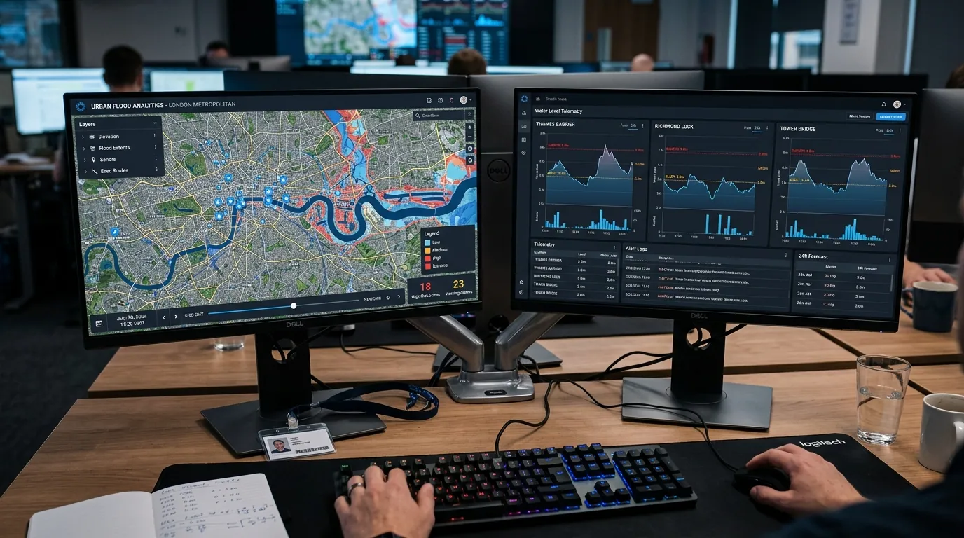
A hybrid GIS visualization and IoT telemetry ingestion platform designed to model urban surface water runoff and ingest live water level measurements from ultrasonic sensors mounted at critical drainage culverts.
Problem Statement
Intense localized urban rainfall causes rapid flash flooding in low-lying city thoroughfares, overwhelming traditional regional weather forecasts.
Project Objectives
✓Ingest digital elevation models (DEM) and urban storm drain vector GIS layers.
✓Ingest real-time water level data from connected ultrasonic IoT field nodes.
✓Render dynamic inundation heatmaps for urban planning and emergency awareness.
Hardware & Sensors
- Ultrasonic water level distance sensor node
- Solar-powered cellular IoT telemetry gateway
- IP67 weather-proof culvert mounting enclosure
- Note: Platform operates as a hybrid software/GIS platform capable of ingesting live IoT sensor feeds or synthetic rainfall model data.
Communication Architecture
MQTT / HTTP REST API ingesting sensor payload JSON packets from field ultrasonic nodes into a GIS cloud server.
Software & Data Processing
- Python GIS processing pipeline (GeoPandas, Rasterio)
- Hydrodynamic digital elevation flow routing algorithm
- Real-time WebGL interactive map dashboard
Implementation Workflow
- Municipal DEM elevation layer ingestion and slope flow routing calculation
- MQTT telemetry ingestion server deployment
- Ultrasonic water level node bench testing
Testing & results
Hydrodynamic elevation flow model validated against historical municipal rain data.
Tech stack
Python GISGeoPandasUltrasonic NodeMQTTWebGL MapDocker
Interested in this project?
Connect with the Alistron engineering team to discuss technical specifications, school workshops, or joint R&D collaboration.
Talk to our engineers